|
Horseley Fields to
Corn Hill A walk along this quiet stretch
of canal reveals industrial dereliction, and modern
high rise dwellings. The silence is only broken by
the frequently passing trains, in and out of the
high level railway station, and the occasional
pleasure boat. Today’s tranquil scene is a great
contrast to the busy, bustling times in the second
half of the 19th century, when a long line of
tightly packed businesses stretched along the canal
bank, as far as the eye could see. Each one of them
relied heavily on the canal for transporting raw
materials or finished goods, and so the sides of the
canal would have been full of activity, coupled with
the sounds and smells of industry. |
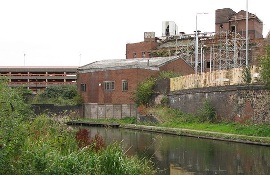
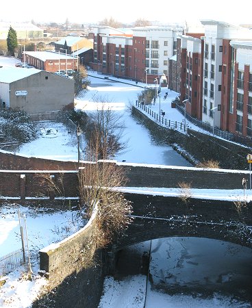
This section of the canal showing the large
number of businesses that were once here.
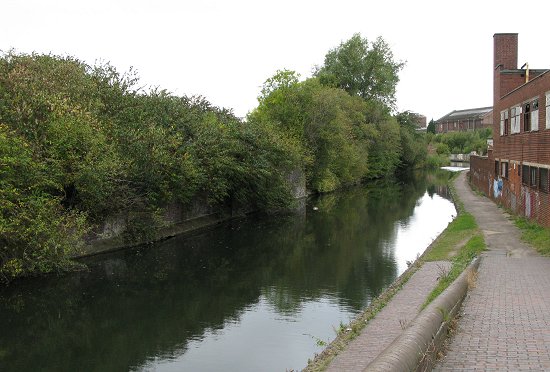
The tranquil scene today, looking westwards
from Horseley Fields Junction.
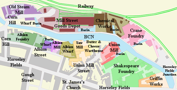
| The original canal, as surveyed by James Brindley,
followed the 473ft. contour around hilly Wolverhampton,
and curved in a north-westerly direction after passing
Albion Mill. It then went under Corn Hill, and followed
a route around the Old Steam Mill, to cross the site
of the High Level railway station, before reaching Broad Street
Warehouse and Broad Street Basin. When the railway
came to Wolverhampton, with the building of the
Shrewsbury and Birmingham Railway, and the Stour Valley
Line in 1849 to 1851, the canal was diverted to its
current path, in a cutting under the top of Corn Hill,
and through the tunnel to Broad Street, and Broad Street
Basin. The original curve into the Old Steam Mill
remained as a short basin, with a wharf for the mill. |
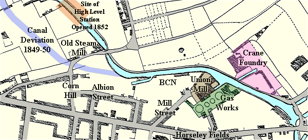
A map based on the 1842 Tithe Map showing the
old and new route through Wolverhampton.
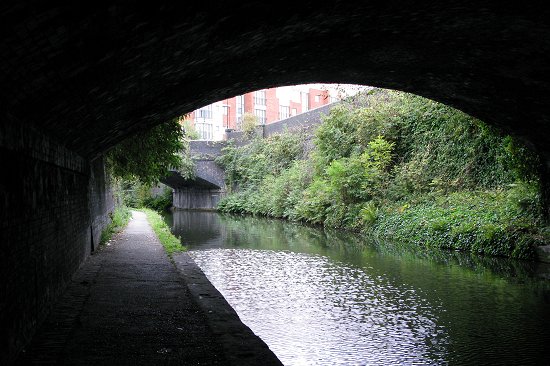
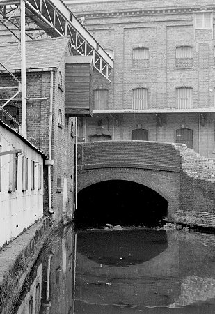
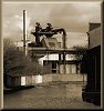
The view from the tunnel, looking
towards the cutting and Mill Street Bridge, which
carries Corn Hill over the canal. The tunnel was built
to carry the station approach that ran from the Queens
Building to the High Level Station. It was extended in
the 1880s when the station approach was skewed away from
Queen Street to meet up with the newly created Lichfield
Street. |
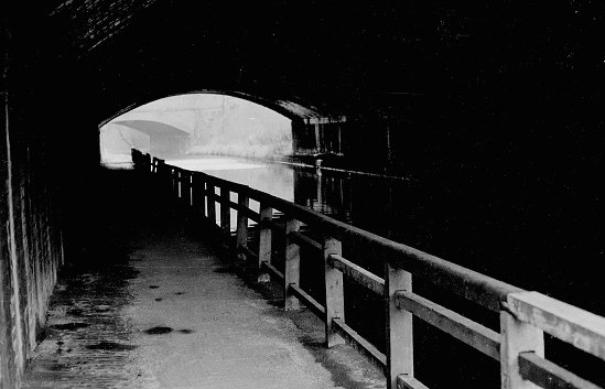
Until about 20 years ago the tunnel had a
rail alongside the canal.
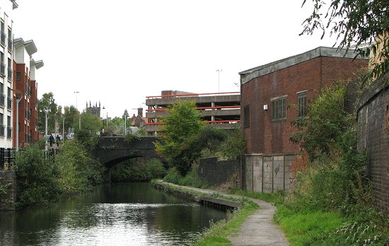
| A final view of
this section of the canal taken in January, 2010.
Corn Hill bridge is in the
foreground, Albion Mill can just be seen on the right,
and in the distance is the butter and cheese warehouse. |
 |
 |
Return to the Canals
and Industry Menu |
|