|
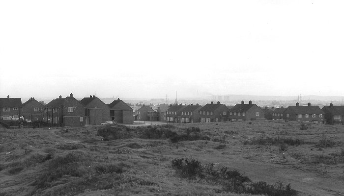
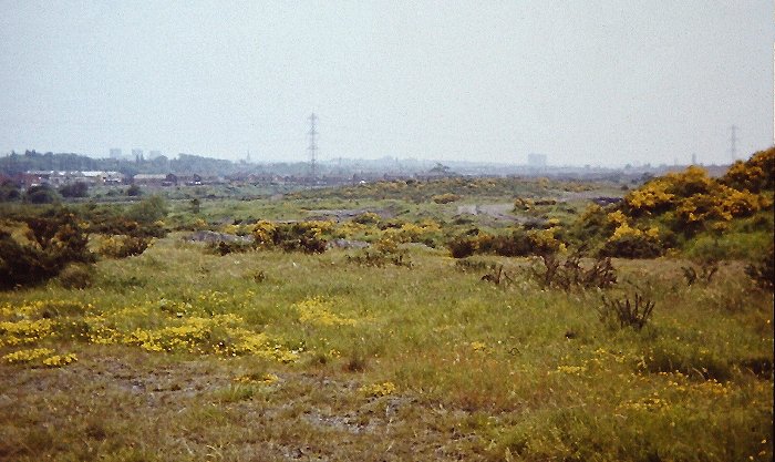
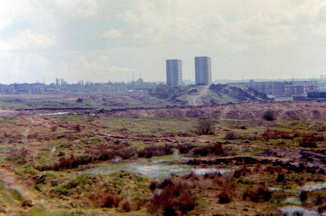
The north eastern corner of Bentley was one of the last
parts to be developed. In the early 1960s only the
southern end of Lime Avenue had been built, Poplar
Avenue only extended from Monmouth Road to just beyond
Attlee Road, and Rowlands Avenue was about half of its
final length. The north eastern corner still consisted
of spoil heaps, hollows and pools, all reminders of the
intense coal mining that once dominated the landscape.
Today the view has changed beyond recognition. The
photos were taken from what is now the top of Lime
Avenue, which was built in the early 1970s. The view to
the north east and the east is looking across what is
now a large playing field, surrounded by modern houses.
I have to thank Christine and John Ashmore for kindly
allowing me to use the photographs below, which were
taken by their father, W. J. Ashmore. |
|
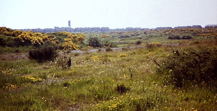
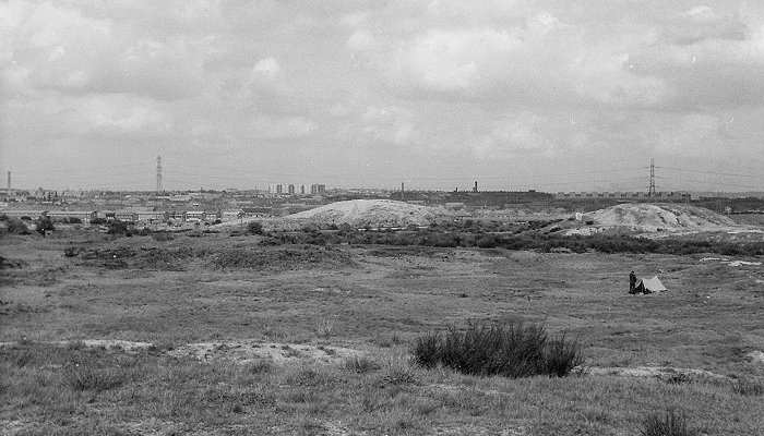
The view from the north east to
the east. |
|
The view from the east to the
south. |
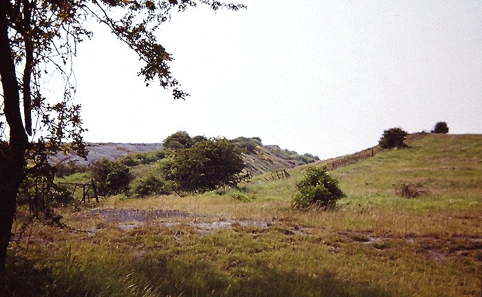
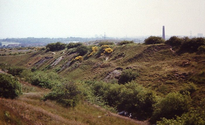
| Close up views of the
panorama: |
|
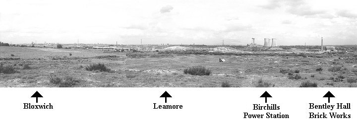
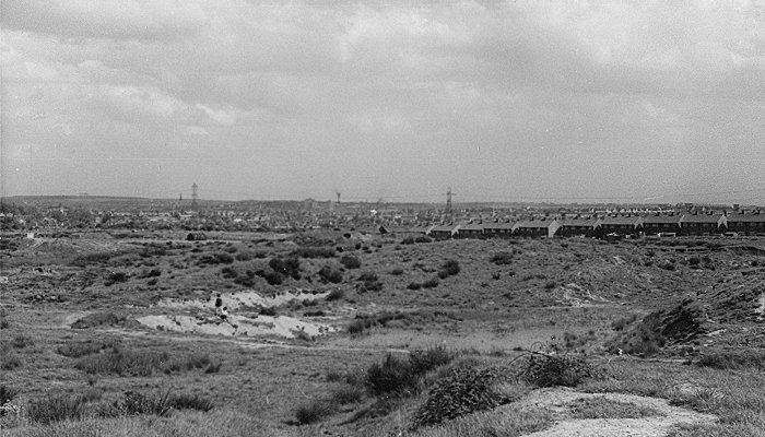
Looking north eastwards towards
Bloxwich and Leamore. |
|
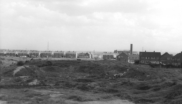
Looking towards Leamore and
Leamore flats. |
|
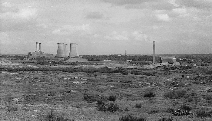
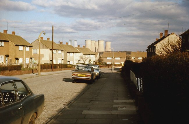
Looking east towards Birchills
Power Station and Bentley Hall brick works. |
|
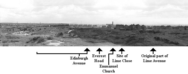
Looking south eastwards towards
the eastern end of Edinburgh Avenue. |
|
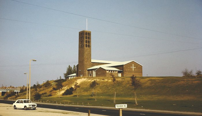
Looking to the south into Everest
Road, with Emmanuel Church to the right. |
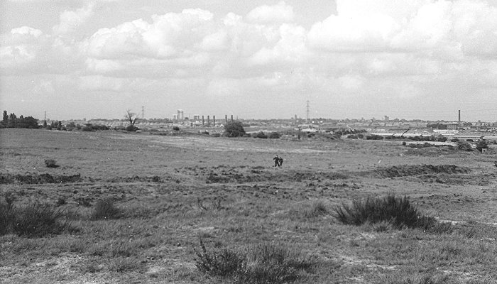
A view looking towards the Bentley
flats and Darlaston, from the early 1960s. It was taken
on an area of open land on the western side of Monmouth
Road, where the playing fields are today. |
|
A second view from the same area,
looking towards Bilston. |
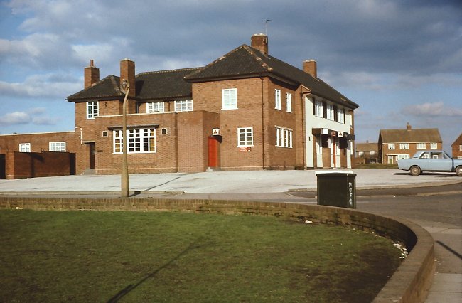
A once well known pub in Churchill
Road, The Old Hall. The building was demolished in 2007
after an arson attack, and replaced by Parsons House
flats, which opened in December 2010. The photo was taken by W. J. Ashmore.
Courtesy of Christine and John Ashmore. |
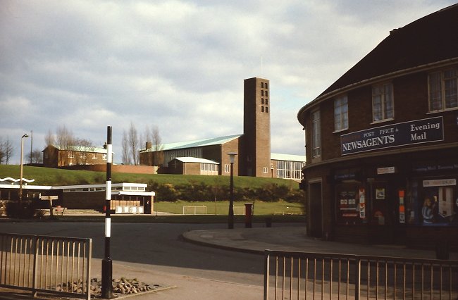
A view of Churchill Road and the
top of Queen Elizabeth Avenue which has hardly changed,
except that Bentley Library on the left, has now gone.
The photo was taken by W. J. Ashmore. Courtesy of
Christine and John Ashmore. |
|
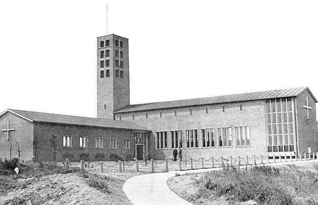
Emmanuel Church in 1963. |
|
The Emmanuel Church in 1972 with
Bentley Library on the left. The photograph was taken by
Richard Ashmore. |
|
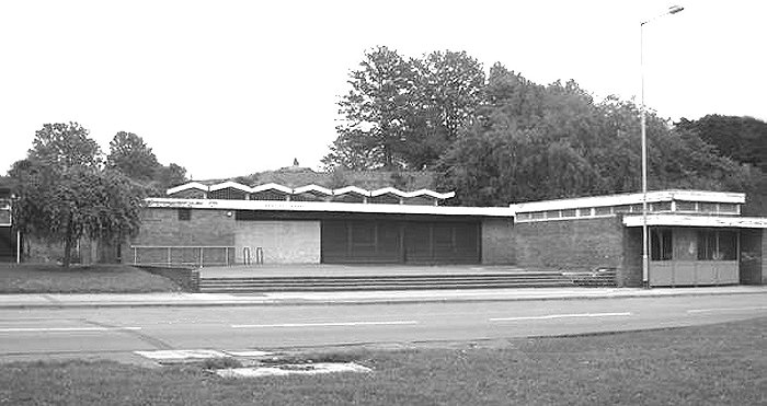
Bentley Library, which closed in
2006 and was demolished a few years later. |
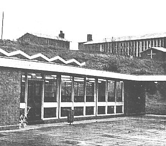 |
A closer view of the library. |
|
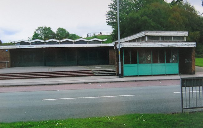
Another view of the library. |
|
 |
 |
|
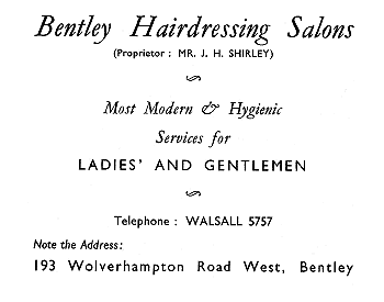
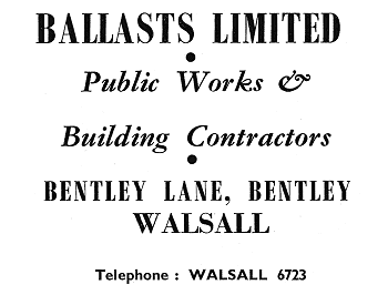
Two adverts from
1954. Courtesy of Christine and John Ashmore. |
|
Queen Elizabeth Avenue in 1963. |
Birchills Power Station dominated
much of the local landscape. A view from Edinburgh
Avenue, Bentley, in the 1970s, looking towards Kent
Road. The photograph was taken by Richard Ashmore. Courtesy of John & Christine Ashmore. |
| In the early 1970s a lot of building work took place
around Western Avenue and Overdale Drive. Also at this time
the old and long disused Bentley Canal was culverted and
turned into the lovely footpath that is still there today. |
|
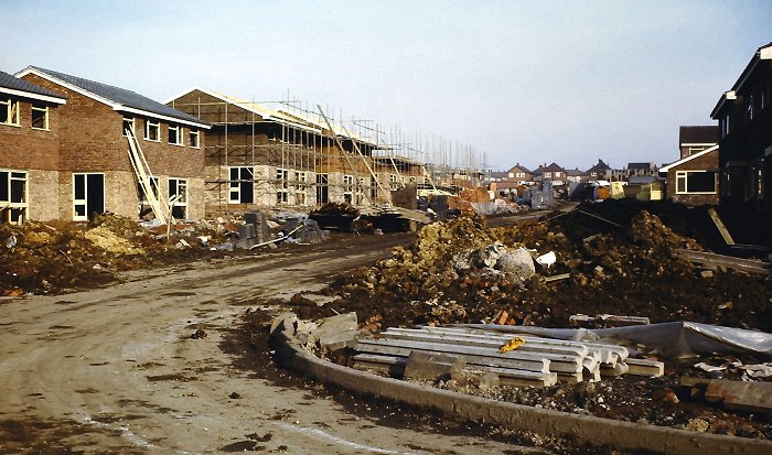
Houses being built in Poplar
Avenue in 1972 or early 1973. The photograph was taken
by Richard Ashmore. |
|
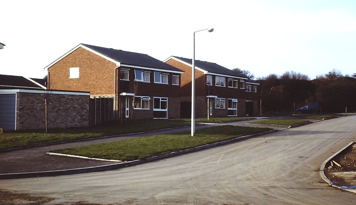
Tenbury Close in 1972 or early
1973. The photograph was taken by Richard Ashmore. |
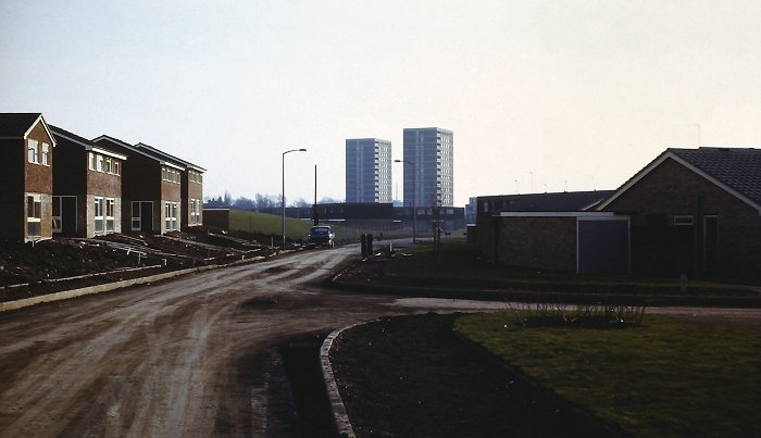
Looking southwards along Western
Avenue in 1972 or early 1973 towards the old Bentley
flats. The photograph was taken by Richard Ashmore. |
|
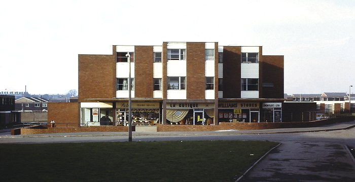
The shops in Farmbridge Road in
1972 or early 1973. The photograph was taken by Richard Ashmore. |
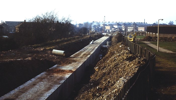
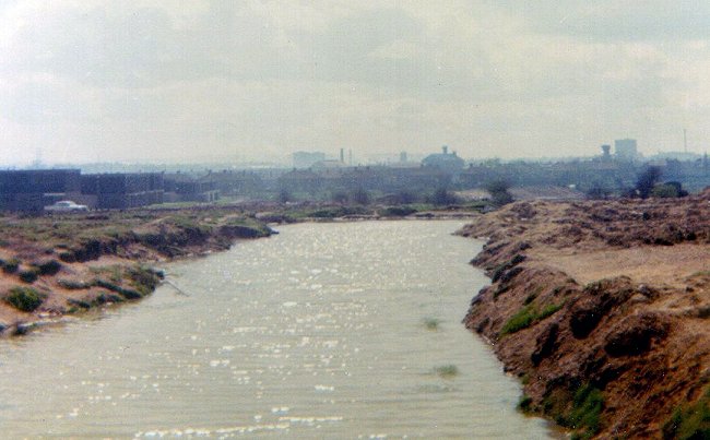
The culvert being built on the
site of Bentley Canal, looking towards Clarkes Lane. The
photograph was taken by Richard Ashmore. |
| Graham Bosworth, who lived at Willenhall in the early
1970s remembers the closure of the canal, which his
garden overlooked. He describes the end of the canal as
follows: "Eventually, the canal bed was excavated from
a few hundred metres to the west of Fibbersley (possibly
the boundary between the boroughs of Wolverhampton and
Walsall) off to the east, possibly as far as the Anson
Branch Canal in Bentley."
"Large prefabricated concrete sections were lowered
into the trench by a crane on caterpillar tracks. I
recall using the site as a playground, running along
inside or above the concrete sections. The sections were
joined together along the length of the former canal to
form a culvert, and the water that had previously
drained into the canal subsequently drained into the
culvert. Walking along the route later, it was possible
to see occasional "man hole" inspection covers. Some
bridges were removed or altered after the canal had
gone, including Fibbersley and Monmer Lane." |
|
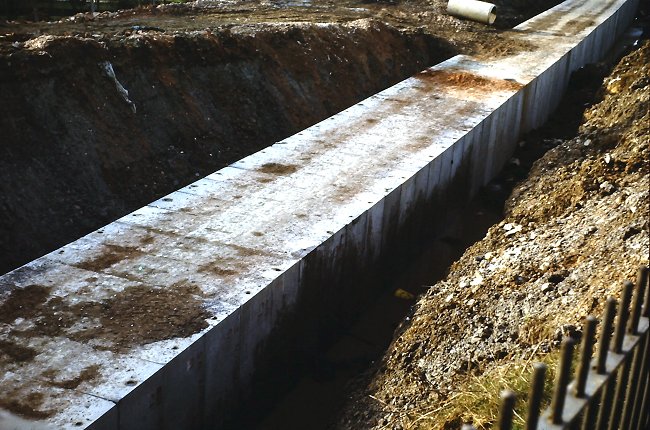
A close-up view of the culvert.
The photograph was taken by Richard Ashmore. |
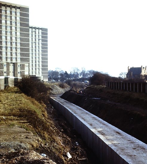 |
Another view of the newly
culverted canal, looking towards Wolverhampton Road West.
In the distance is the cemetery with
the old flats on the left.
The photograph was taken by Richard Ashmore. |
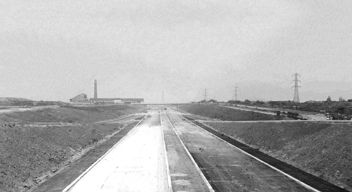
This photo, taken during the
building of the M6 Motorway, includes the once familiar
view of the Bentley Hall Brickworks, that overshadowed
the motorway. |
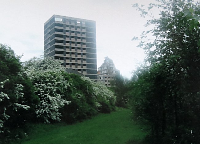
| In 2007, Bentley's two tower blocks, Fairview Court and
Grange Court were demolished, after several years of
dereliction. The four photos below were taken just before,
and during demolition. |
|
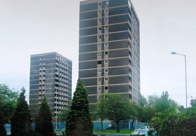
The site is prepared for
demolition. |
|
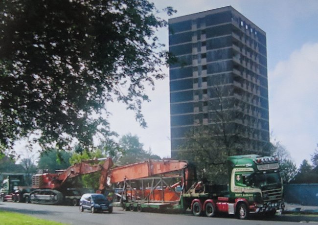
The heavy machinery arrives. |
|
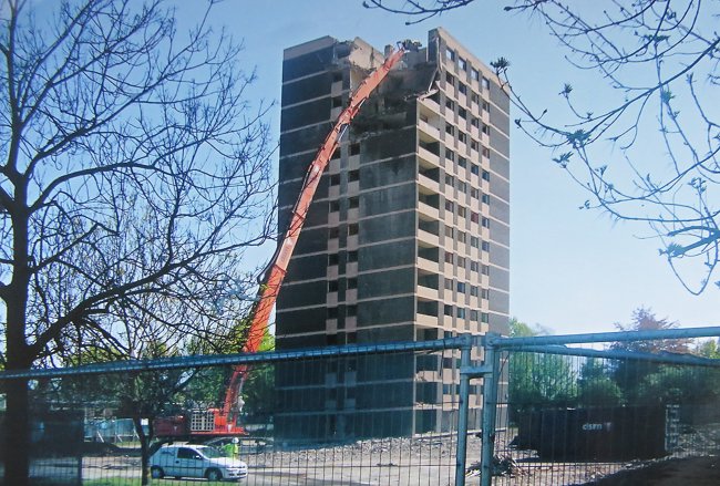
Demolition gets underway. |
|
A final view of the demolition, as
seen from the nearby footpath. |
 |
Return to
the
previous page |
|