3. The Medieval and
Early Modern Village
And then there is Domesday Book. In it we find
that Wednesfield was in Offlow Hundred (a hundred was an administrative
unit; the hundreds were carefully defined throughout the country but
never seem to have been of much administrative importance in themselves,
though they did hold Hundred Courts). We also find that:
“The canons [of Wolverhampton] themselves have five hides in Wodnesfelde.
The land is three carucates. There are there six villiens and six
bordars having six carucates. The woods with pannage are half a
league long and three furlongs wide”.
|
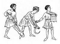
Digging, harvesting and sewing. |
This is not as clear as it might be.
It is normally reckoned that a “hide” and a “carucate” are the
same thing – but that “carucate” was used in the Danelaw and
“hide” elsewhere. If this is the case then Domesday Book
may be saying that Wednesfield was in the Danelaw and
Wolverhampton was not; or maybe they were just recording a
local usage. In any event both terms mean an area of land
which could be ploughed by one plough team in each year's
ploughing season. How much this was in terms of acreage,
depended on the nature of the soil; so it is often reckoned as
being between 100 and 300 acres. |
|
By this reckoning the canon held
between 500 and 1500 hundred acres and others (assuming that the figures
are cumulative) held between 600 and 1800 acres.
The reference to woodland is
quite usual for Domesday Book entries but the fact that it is subject to
pannage is not. Pannage was the right to let your pigs “grovel for
acorns”. It may be that the local people were great swineherds –
or simply that it was recorded because there had been a dispute about it
in the past.
The entry mentions twelve people
living in the area. But this cannot be taken as being the sum
total of its permanent population. Each person mentioned probably
represents a family of, at the least, four; and some locals would not
get a mention at all. So let us take a wild guess and say that
between 50 and 100 people were living in Wednesfield in 1085.
|

Felling trees - the
first step in land clearance. |
|
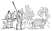
Swine in the forest. |
Most of them would have lived in a
central village, presumably where the town centre now is.
A few might have lived outside it. Around the village
would be some meadow land, some land held in demesne by the
cannons, and a series of great open fields which would have
been cultivated, in furlong strips, by the villagers and the
canons. |
| Domesday Book does not mention a
mill. Quite possibly there wasn't one – mills at the
time were water mills and there does not seem to be a
sufficient stream in the area to power one. But later
there was a windmill.
We can get a picture of the village in
the centuries after Domesday book. The village houses
would have been sited along the length of road which is now
called High Street and Rookery Lane. One end would
have been where the Dog and Partridge now stands and the
road out of the village splits. The statutory listing
of this venerable pub says that it is “probably of late
sixteenth century origin” and it is quite possible that
there was a building on the site before that. The
other end of the village would have been somewhere near the
where St. Thomas's now stands. That church was built
on what was, up until then, the village green. |
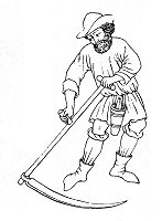
Mowing with a scythe. |
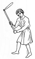
Threshing with a flail. |
Most of the eastern half of the area
was occupied by the Priest's Wood – Prestwood. Here
the villagers would not only have let their pigs forage but
they would almost certainly have been allowed to take wood
for fuel, fencing and even house building. Around the
rest of the village lay the open fields, of which here seem
to have been four. Although most villages had three
such fields, some had two and some had four. The four
fields were Northlow Field, Luchfield, Southlow Field (aka
Windmill Field) and Church Field. The villagers would
have held strips in each of these fields and the course of
agriculture in them would have been determined by the
Manorial Court. |
| An important factor in the lives of
the villagers was the fact that Wednesfield lay within a
royal forest. A forest was an area of land, not
necessarily wooded, which was preserved as a royal hunting
ground – even though the King might well not own the land.
The effect was to limit what others might do in such an area
and the villagers of Wednesfield would not have been allowed
to take wood or anything else from the forested land nor
take in dogs or hunt for anything, nor graze pigs or cattle.
The Laws of the Forest were strictly enforced, anyway from
time to time; and did not effectively fall into complete
disuse until the late seventeenth century. |
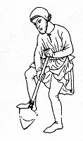
Digging. |
Over the centuries the cultivated area would have
been extended by new areas being cleared and taken into the common
fields or becoming separately owned fields. Even the Prestwood was
eaten into. This was the usual state of things in central England
as a whole but something sightly unusual seems to have been happening in
Wednesfield (and in a few other parts of South Staffordshire).
People were acquiring large tracts of land, on the outskirts of the
manor, and clearing them for agriculture. In the centre of these
pioneering lands they built farm houses surrounded by a moat. Smallshire identifies these at Ashmore, Prestwood, Moathouse and
Merrill's Hall. He also suggests they may have existed at
Newbolds, Rumbelows, Blackhalves and Perry Hill. Neachells may
have been an even odder case of a whole farming hamlet surrounded by a
series of moats.
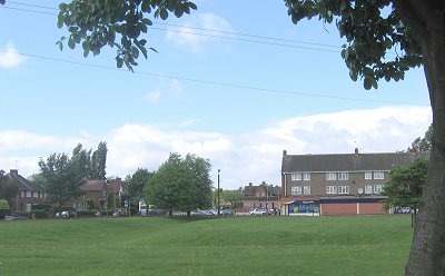 |
The moat at Ashmore can be seen as
a depression in the grass, in front of the shops at Ashmore
Park. |
From the sixteenth century
onwards, and increasingly as the years went by, open fields were
enclosed – that is, the old strips were abandoned and they and the open
fields were re-designed as fields of a modern size and shape and
individually owned. This could be done under an Act of Parliament
passed for each area or by agreement between those interested in the
strips. There is no Act for Wednesfield and enclosure must have
occurred by agreement. But it was unusually late for the area,
perhaps not being complete until about 1800 – or, in small patches,
until much later, the existence of strips being mentioned in the 1840s.
Smallshire notes, very briefly, that this lack of enclosure may have
been a brake on industrial and other development in the area. (In
this he was a bit before his time: the use of enclosure for
development reasons other than agriculture was not widely recognised
when he wrote).
It has to be said that, until
the 1700s, not much seems to have happened in Wednesfield. The
round of the agricultural year went on though, aided by enclosure,
bigger landholdings appeared. Smallshire thinks that the Levesons
became the biggest landowners and seems to think that they did so by
fair means and foul. However, the court records of the time are
difficult to interpret, particularly where many apparently violent land
disputes are legal fictions used to try the ownership of land.
Smallshire examined many court records of the period and his book
contains many names of local families, which may be of some interest to
genealogists but which do little to advance our understanding of the
areas history.
Even the Civil War seems to have
left little mark, the exception being the unfortunate Francis Pitt, a
yeoman farmer of Wednesfield Heath and, at 65, a good age for the time.
This elderly man was persuaded by Colonel Thomas Leveson to try to
negotiate the surrender of Rushall Garrison. But when Pitt got to
Rushall he was arrested, dragged of to London, tried, sentenced to death
and executed. He would have been but one to lose his life,
The Civil War resulted in a greater number of English deaths than any
other and doubtless the people of Wednesfield suffered the hardships of
war, whichever side they supported and whether they joined the armed
forces or not.
|