|
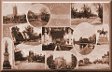
More Images
of Wolverhampton from Old Postcards
by Bev Parker
Parts of old Wolverhampton have changed to such an
extent that they are almost unrecognisable today.
Luckily, over the years, many photos of the old town
have been reproduced on postcards, which give us a
'snapshot' of life in the past. I have included a
variety of images, some of streets that have hardly
changed and others that are now very different. |
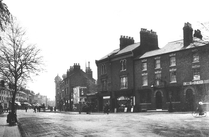
An early view from the bottom of Chapel Ash,
looking into Merridale Road, with Compton Road
on the right. On the left is the Old Bell Inn.
The white building on the corner of Compton Road
has a sign above the front door, carrying the
name 'The Crown', suggesting that it is a public
house. Unfortunately I cannot find any reference
to it other than that it was a cycle shop a few
years later. The small single storey building next
door was a telegraph and post office. In the background
on the left is the spire of the Presbyterian
Church, built in 1869. It was on the corner of Merridale Road and Lord Street. |
The view from the end of Compton Road, looking
towards Chapel Ash. The Old Bell pub in
Merridale Road is on the right, next to a
variety of small shops. |
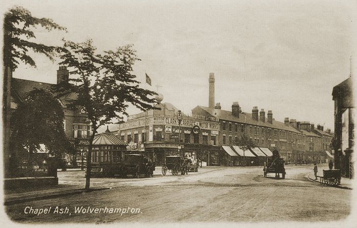
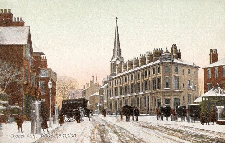
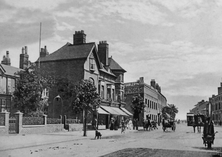
Looking towards Chapel Ash and its junction with
Tettenhall Road and Bath Road. On the left is
the the old cab drivers' shelter and a couple of
parked cabs, waiting for a fare. On the corner
of Bath Road is Clarke's Carriage and Motor
Works that was established by Edward Clark in
1843, to produce carriages and carriage wheels. |
|
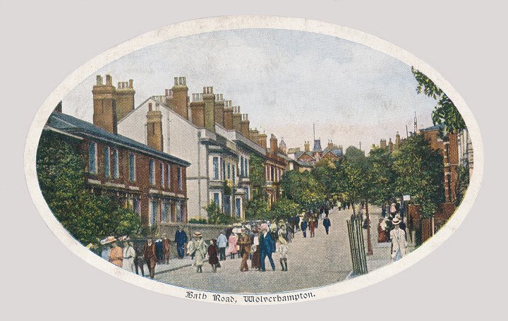
Looking up Bath Road towards Waterloo Road. |
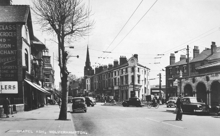
A view of Chapel Ash from Tettenhall Road in the
1950s. On the right is the shelter, and on the
far side of the road is the Alexandra Hotel, on
the corner of Clifton Street. The spire of St.
Mark's Church can be seen in the distance. |
|
A view of Chapel Ash from Tettenhall Road in
the early 1900s. |
|
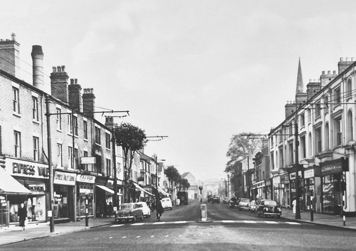
Looking up Chapel Ash towards Darlington
Street in the 1960s. |

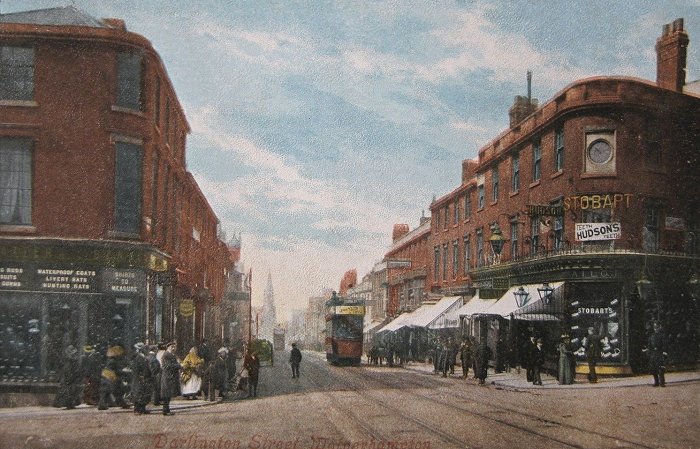
A fine view of Darlington Street from the early
years of the 20th century. In the distance is a
Wolverhampton Corporation Tramways tram on its
way to Tettenhall. It used the Lorain system
with electrical contact boxes in the road,
between the rails. Some of them can just be made
out in the photo. On the right is the new
Methodist Church that had opened a few years
earlier in 1901. On the right is a fine row of
shops with an archway by the street light. This
led to a yard at the back that contained Cogent
cycle works and a malthouse. |
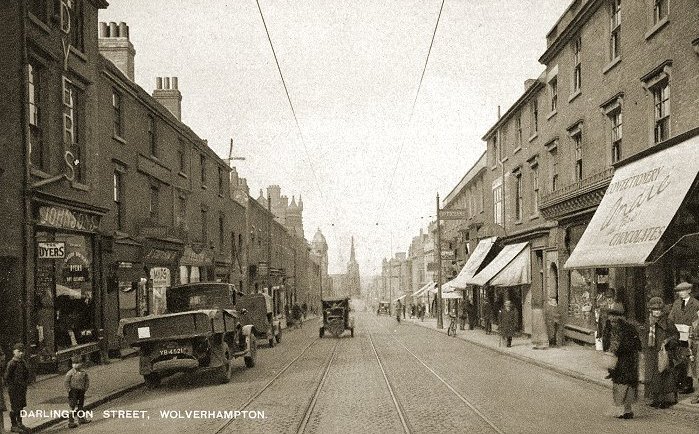
Another view of Darlington Street from the early
years of the 20th century. There are two
Wolverhampton Corporation Tramways trams, one on its
way to Tettenhall and the other returning to the
terminus. In the distance is St. Mark's Church. |
A view from the late 1920s. On the left is Johnson
Brothers' dyers and cleaners shop, and on the right
is André et Cie, seller
of confectionery and chocolates. A few doors away is
a prominent Opticians' sign, outside the premises of
H. Howard Limited at number 95. St. Mark's Church is
very prominent in the distance. Courtesy of
Ralph Hickman. |
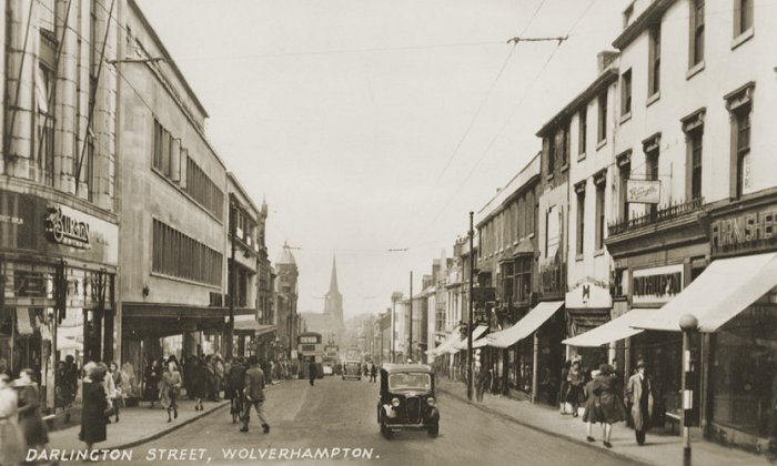
A 1950s view of Darlington Street with T. W.
Phillipson's tobacconists and Weiff Brothers fashion
shop on the right. On the left is Montague Burtons' tailors and Beatties. |
|
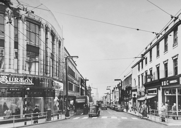
Another 1950s view of Darlington Street |
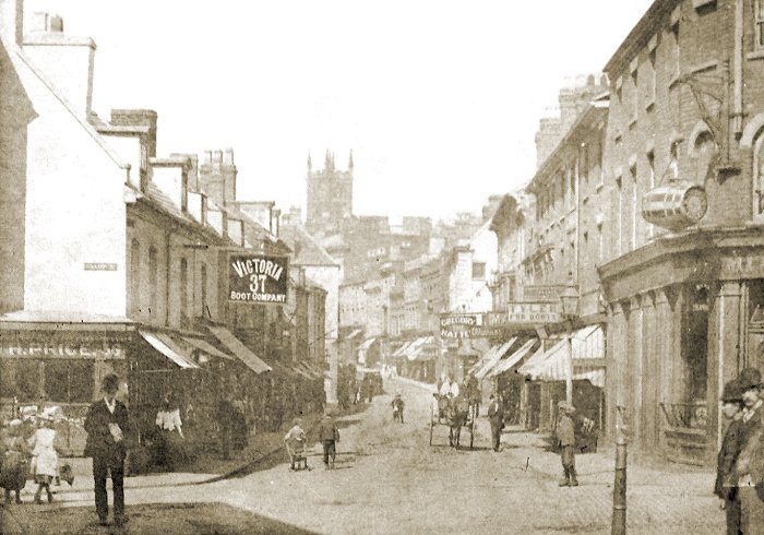
Looking into Victoria Street from Worcester Street
at the beginning of the 20th century. On the right,
at the junction with Cleveland Street is the Mitre
pub, which closed in 1975 and has now been
demolished. A few doors down in Victoria Street is
Mrs. Ezra Tyler's boot and shoe shop. On the left at
the junction with Salop Street is Henry Price's
fruit shop and a few doors away, the Victory Boot
Company. |
|
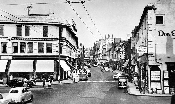
Victoria Street in the early 1950s wiith Don
Everall's shop on the right and the Hippodrome
in the distance. |
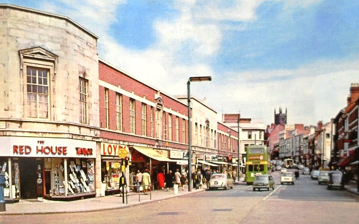
Victoria Street in the 1960s. On the left, at the
junction with Salop Street is the Red House
(Wolverhampton) Limited, outfitters. Next door is
Lloyds Retailers Limited, radio dealers, followed by
the British Bata Shoe Company Limited, T. H. Baker,
jewellers, and Taylors' bakers shop. A few doors
down is Aldridges Restaurant that was previously in
Lichfield Street, opposite the old post office. On the extreme right
is Ideal Cleaners, Meesons Limited, confectioners,
and C. D. Field, butchers. |
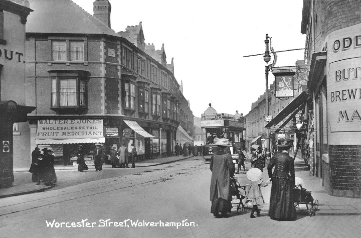
Worcester Street in about
1910. On the extreme right at the bottom of
Temple Street is The Odd Fellows pub, which
closed in 1960. From an old postcard. |
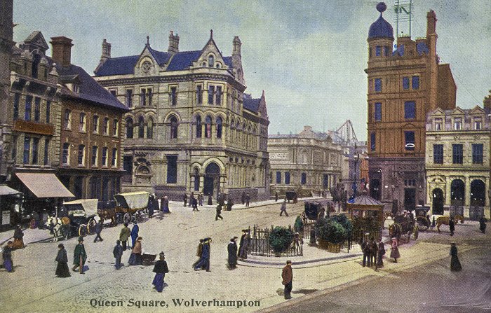
Queen Square in 1902. The track for the Lorain
trams, which can be seen from Lichfield Street, just
right of centre to the bottom left-hand corner, had
just been laid, initially for the Wolverhampton Art
and Industrial Exhibition in West Park, followed by
the section along Tettenhall Road to Tettenhall via
Newbridge. At the time, the Royal London Building,
which can be seen behind the Art Gallery, was nearing
completion. Courtesy of Ralph Hickman. |
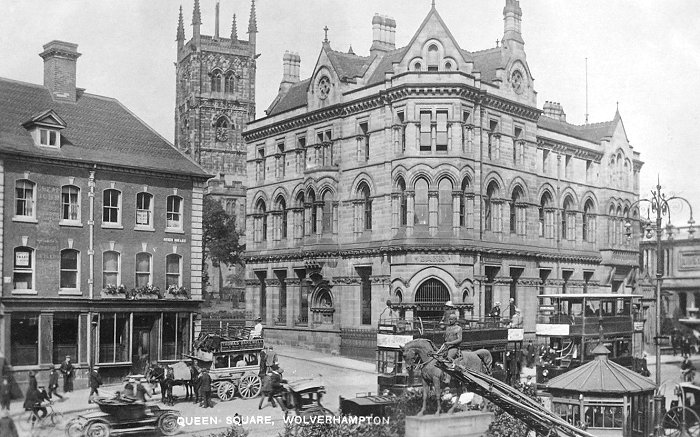
A slightly later view of Queen Square showing many
forms of public and private transport. There are two
Lorain trams, a horse-drawn cab and a horse-drawn
omnibus, one of the last of its kind, which was operated by
Thomas Bakewell. There is also an early motorcar and a couple of
bicycles. |
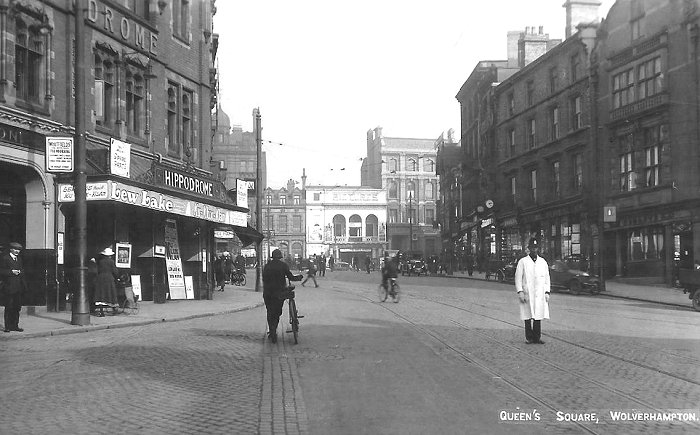
A view of Queen Square from about 1930. At the
time, Lew Lake, the actor and writer who had a
touring variety company, was appearing at
the Hippodrome, as he did on many occasions. In the distance
is the Queens Cinema. Before traffic lights were
installed in Queen Square, there was usually a
policeman on duty controlling the traffic, at the
busy road junction. |
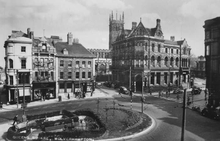
Queen Square in the 1950s. Across the road is Currys
radio and television shop, next door to Cope's Wine
Lodge which would shortly close. In the foreground
are the underground public toilets. |
|
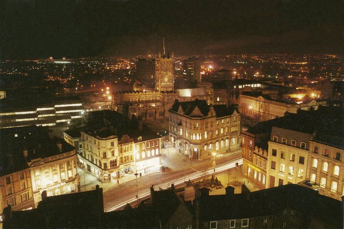
A fine night-time view of Queen Square in the 1980s.
Courtesy of Ralph Hickman. |
|
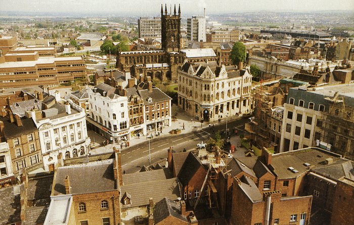
A daytime view of the previous photograph, taken
around the same time. Courtesy of Ralph Hickman. |
|
Another daytime view
of St. Peter's Church and Queen Square. |
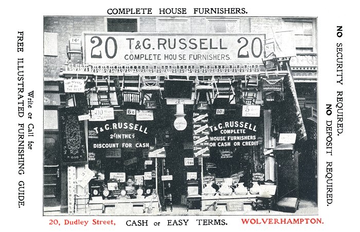
A postcard advertising the services of Thomas and
George Russell, whose shop at 20 Dudley Street
opened in about 1900 and had closed by 1925.
Courtesy of Ralph Hickman. |
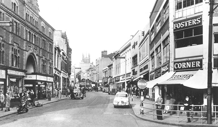
A fine view of the Central Arcade and Dudley Street
in the early 1960s, before the building of the Mander
Centre. On the left is a seed merchant's shop run by
John E. Knight & Son, and on the right, on the corner
of Bilston Street is Foster Brothers Clothing
Company Limited, men's and boys' outfitters and
tailors. Courtesy of Ralph Hickman. |
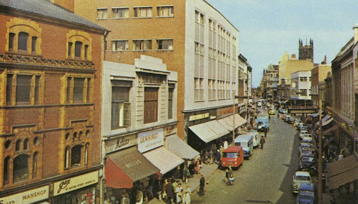
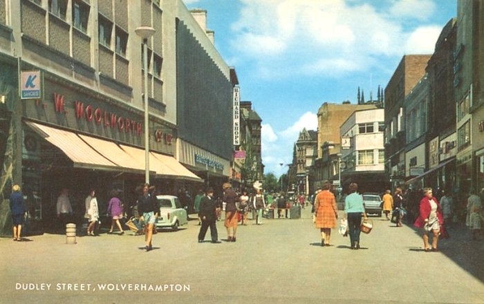
Dudley Street in the 1970s, before the
disastrous fire in the Central Arcade on the
20th May, 1974. Courtesy of Ralph Hickman. |
|
Dudley Street in the 1980s, after pedestrianisation. |
|
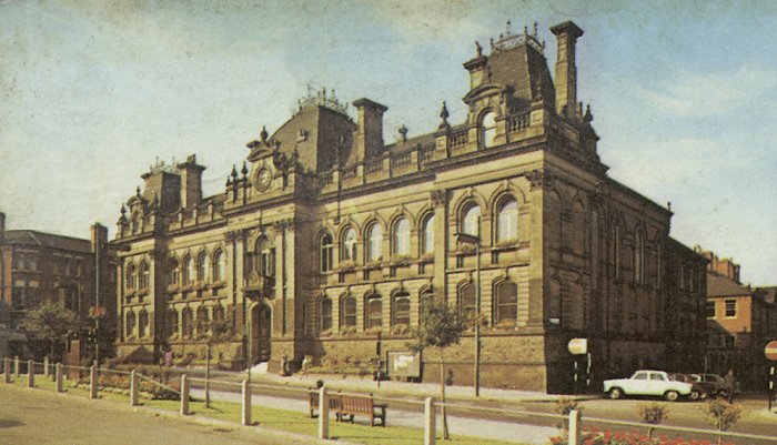
The Town Hall in the 1970s, before work started
on the Civic Centre. Courtesy of Ralph Hickman. |
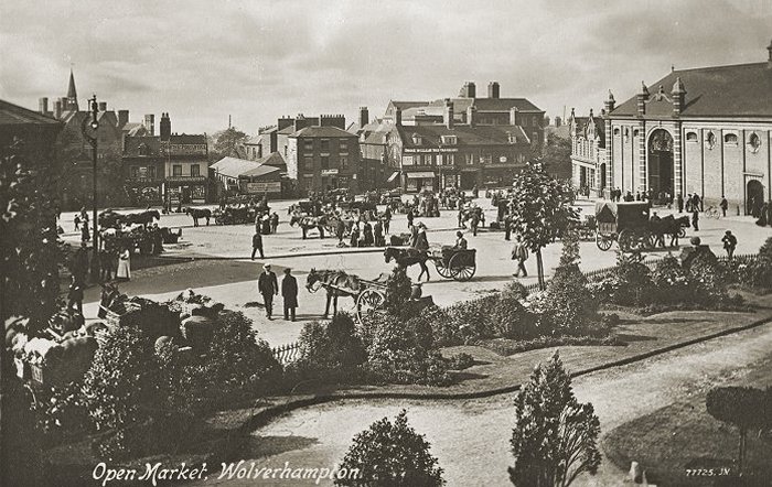
The old site of the outdoor market, between the
Wholesale Market on the right and the Retail Market
on the left, where the Civic Centre is today. It was
also occasionally used as a fairground. Courtesy of
Ralph Hickman. |
|
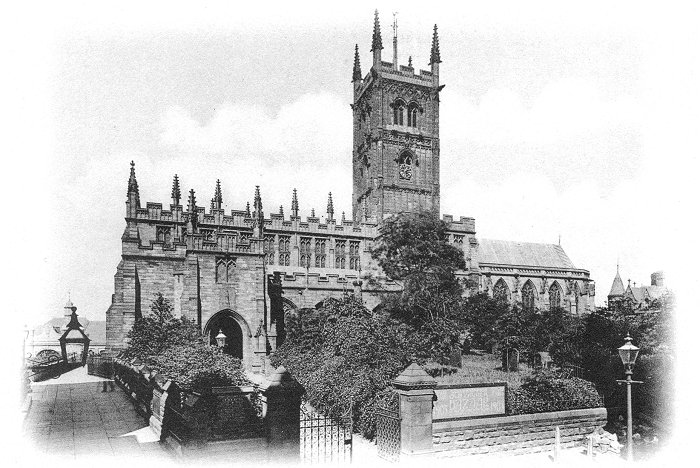
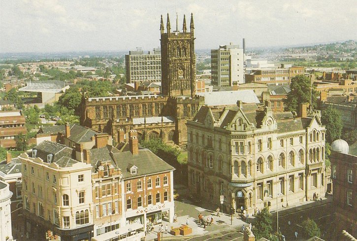
St. Peter's Church in 1905.
The sign advertises the Wolverhampton Old Church
Bazaar. Courtesy of Ralph Hickman. |
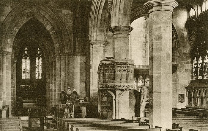
The interior of St. Peter's Church, looking towards
the chancel, with the eagle lectern and the pulpit.
Courtesy of Ralph Hickman. |
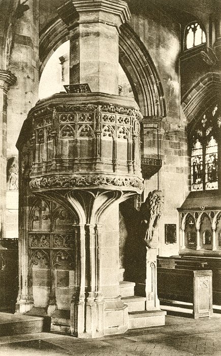
| A close-up view of the stone pulpit
and the carved figure of a lion at the foot of
the steps, to protect the Minister.
Courtesy of Ralph Hickman. |
 |
|
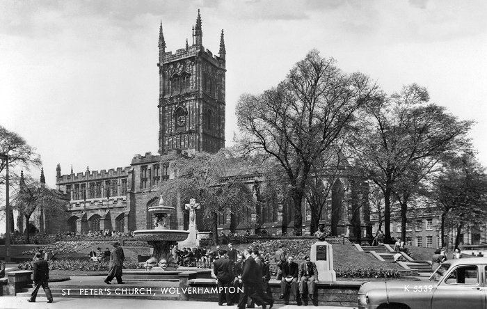
St. Peter's Church and gardens on a fine summer's
day in the early 1960s. Courtesy of Ralph Hickman. |
|
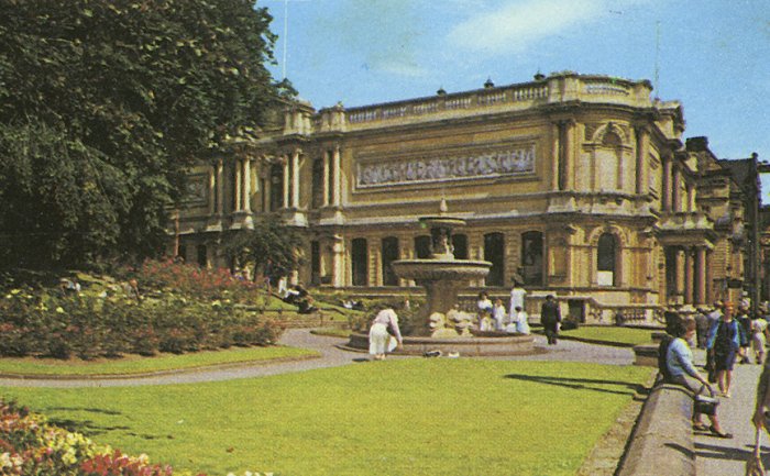
St Peter's gardens and the Art Gallery in the
mid 1970s. Courtesy of Ralph Hickman. |
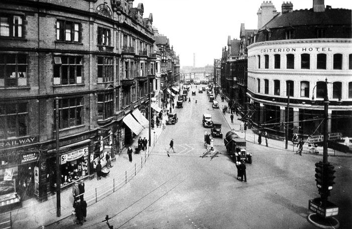
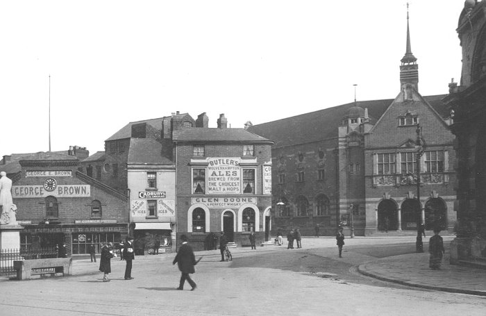
A view of Princes Square and Lichfield Street in
the second half of the 1930s, from the Royal
London Building. The recently installed
pedestrian barriers, designed and built by
Steelway at Monmore Green in 1934 can be seen in
the foreground and a set of early traffic lights
is on the right. The Criterion Hotel, which
became the Valhalla in 1976 is also on the
right. |
A late 1920s view of Princes Square from the
opposite direction, looking towards the Art Gallery
and Barclays Bank. On the ground floor of the Royal
London Building is Price Lewis & Company, ladies'
and men's tailors. They were there for many years.
The traffic is controlled by the policeman, dressed
in white, in the centre of the square. |
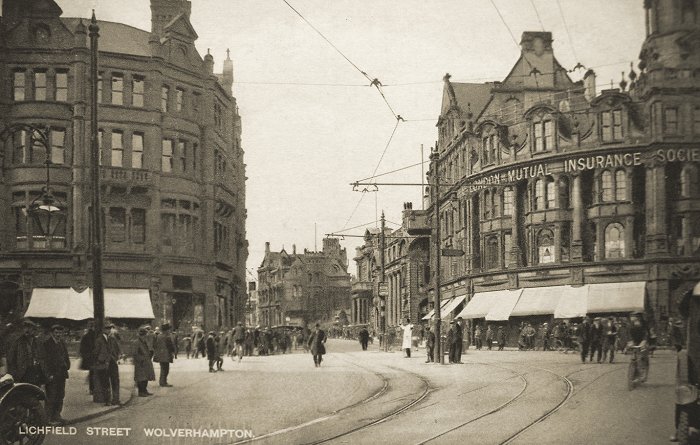
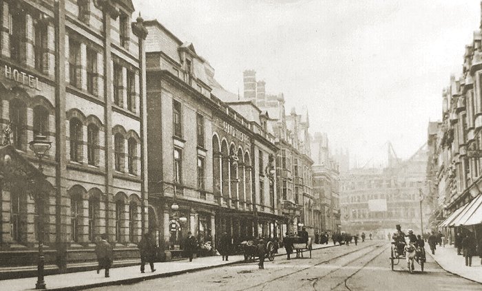
A view of Lichfield Street from around 1900. On
the right is the main post office which opened
on 29th March, 1897 and is now known as 'the old
post office'. In the distance is the Grand
Theatre, the Victoria Hotel, and Victoria
Square. The old post office closed in 1965, when
the new post office opened next door, along with
sorting offices in Horseley Fields, Whitmore
Reans and Wednesfield. |
|
Another view of Lichfield Street from around
1900. |
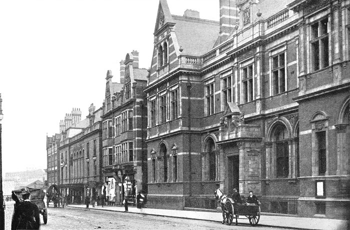
A view of Lichfield Street from 1902. The new
tram lines had been laid and the Royal London
Building was nearing completion. |
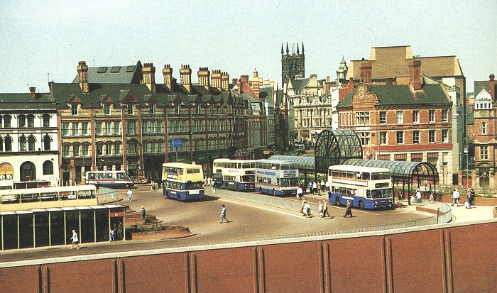
Wolverhampton's previous bus station, which
opened on the 26th October, 1986. In 1990
the Queen's Building became part of the bus
station complex. The bus station closed in
April 2010 and was replaced by the existing
bus station, which opened in July 2011.
Courtesy of Ralph Hickman. |
|
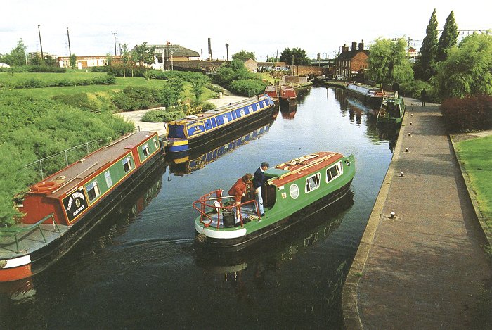
A busy Broad Street Basin on a fine summer's
day. Courtesy of Ralph Hickman. |
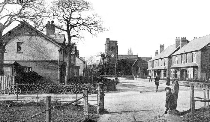
Looking across Coalway Road into Church Road,
Penn, in about 1905. The track in the foreground
led to Coalway Road Playing Fields, where many
local football teams played. In the distance is
St. Philip's Church, which opened in 1859.
Courtesy of Ralph Hickman. |
 |
Return to
the
previous page |
|