| In 1970 I purchased my first quality camera, a Pentax
Spotmatic, which performed extremely well. I began to
photograph local areas that were about to be redeveloped, or
change in some way. I wanted to keep a record of the
once-familiar streets, so that in the future I could look at
them again, and re-kindle old memories. I have included a
few of my photographs from that decade. Some scenes have
changed little, others have changed completely, and are now
almost unrecognisable. I hope the photographs below will
bring back memories for you, or if you are too young to
remember the scenes, you can see how things used to be
around forty years ago, in a very different world.
Steelhouse Lane and the
Surrounding Area |
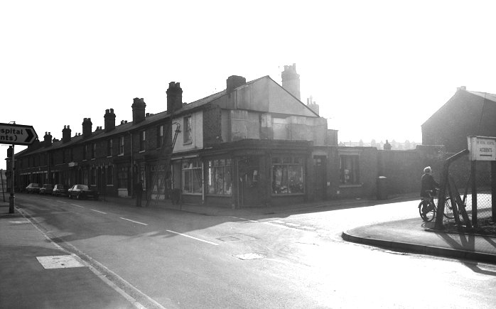
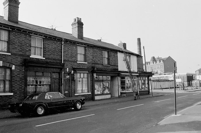
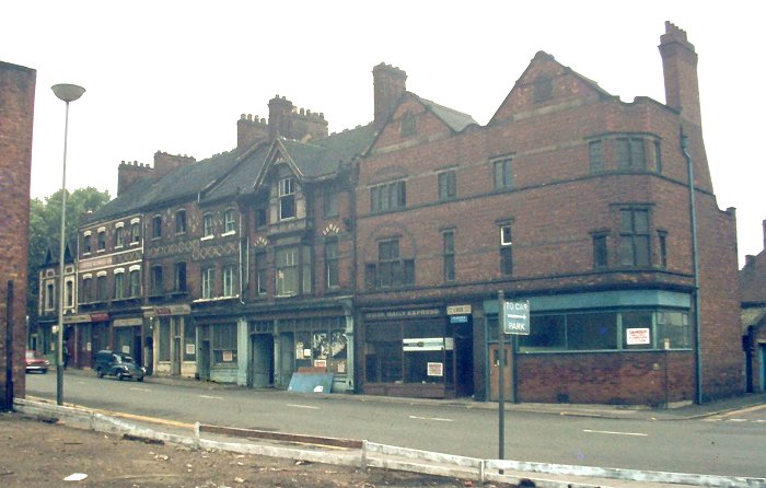
A sunny day in Steelhouse Lane. On the right is
Sutherland Place, with signs pointing to the Royal
Hospital's accident and emergency unit. On the far
corner of Sutherland Place is Wiltshire's shop, and next
door in Steelhouse Lane is a butchers run by A. Ford,
then a clothes shop, and two doors away the shop run by
fish merchant, A. M. Rogers. |
|
A close-up view of the shops, with Dixon's building in
the background. |
|
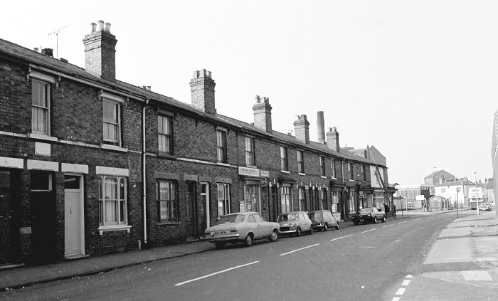
Another view, a little further along Steelhouse Lane.
|
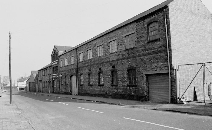
Looking into Jenner Street from Steelhouse Lane. Across
the road is the factory of Edwin Preston Limited, brass
founders. |
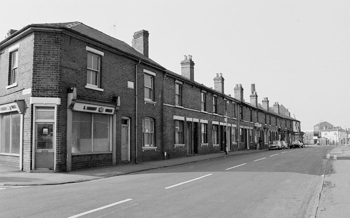
A view looking along Steelhouse Lane from Gordon Street
on the left, towards Cleveland Road in the far distance. |
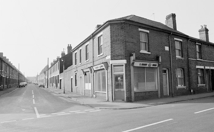
Looking into Gordon Street from Steelhouse Lane. The
shop on the corner at number 232 was occupied by
Wulfruna Refrigeration Services Limited, who repaired
refrigerators. |
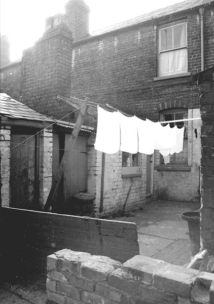 |
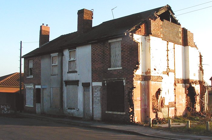
A back yard behind one of the old houses in Gordon
Street that has long disappeared. The rear extension
with the chimney would have been for the kitchen. The
small building on the left would have been the outside
toilet. The small wooden building may well have been the
coal shed. |
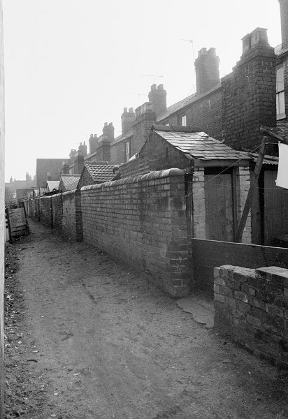
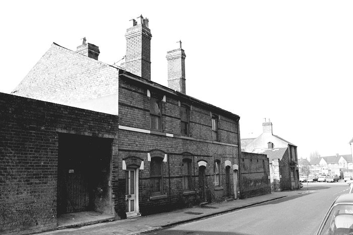
| A look at the alleyway that ran behind the old
houses in Gordon Street. |
 |
|
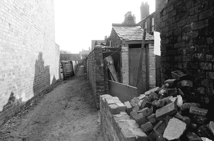
Another look at the alleyway. |
|
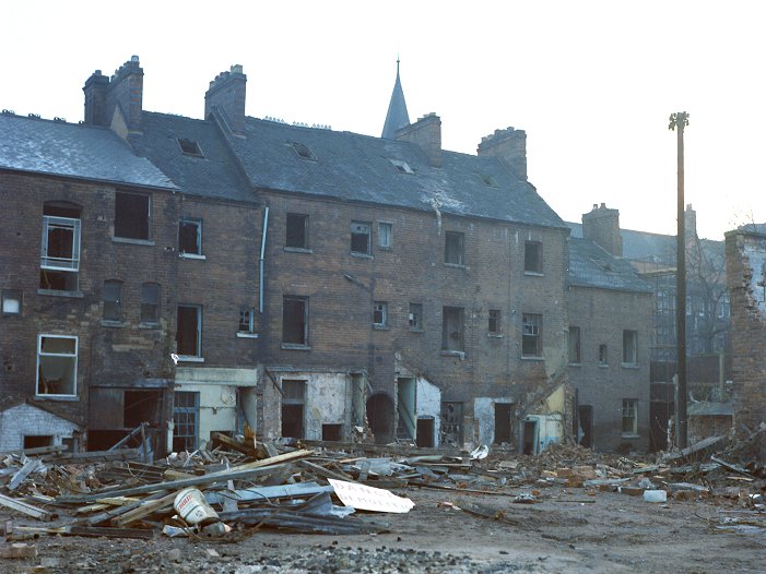
The last of the old houses at the eastern end of Gordon
Street, during demolition at the end of 2001. |
|

The inside of the end house, as seen through the open
doorway. |
|
A final look at Gordon Street. As seen from Vicarage
Road. |
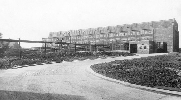
Steelhouse Lane ran alongside one of the largest
factories in the area, Bayliss, Jones & Bayliss. This
photo is of the Metal Forming Plant. In the background
on the left is All Saints Church. Courtesy of Nina
McCarthy. |
Close to the northern end of Steelhouse Lane, off
Cleveland Road, is Hospital Street. The view above is of
the terraced houses that were on the western side of the
street. On the right is Bilston Street. |
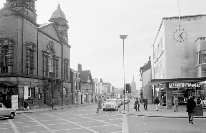
| Lichfield Street,
Queen Square, Queen Street and Dudley Street |
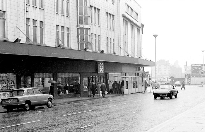
The large Co op store that was in Lichfield Street. The
left-hand part of the building is now the Moon Under
Water pub. In the distance on the right is Victoria
Square. |
|
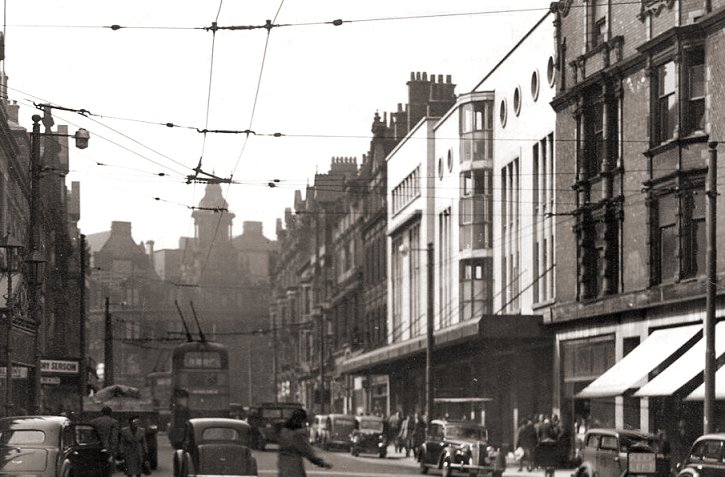
The Co op store as seen in the
1950s when it was very popular. |
A Christmas view of Lichfield Street, taken from Princes
Square. On the extreme left is TV rental company
Telefusion. To the right is the Co operative Permanent
Building Society; Modern Shoe Repairs Limited; Edward
Parry's wonderful ironmongers shop; a Chinese
restaurant; J. E. & A. D. Ongley, hairdressers; and the
Wolverhampton & District Building Society. |
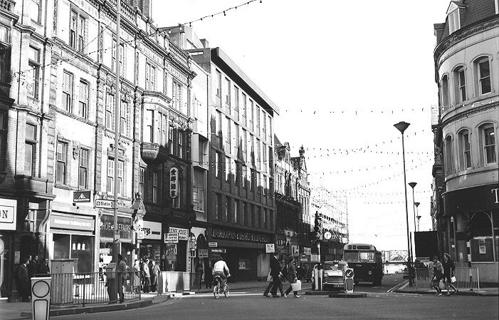
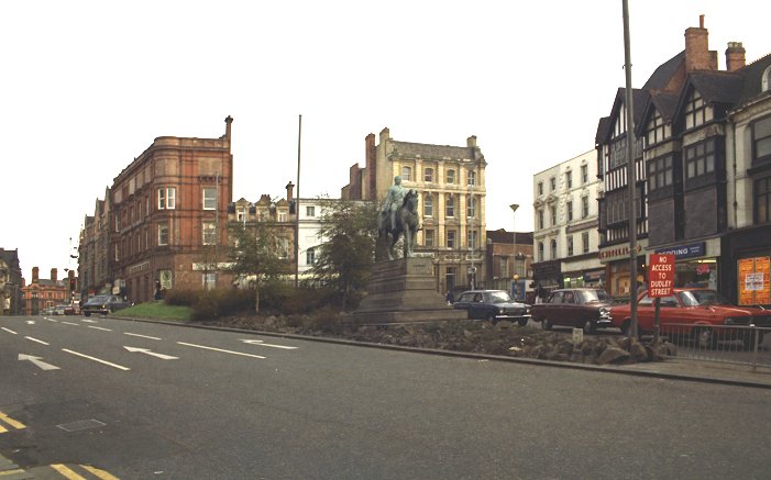
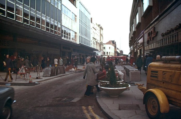
A look at Queen Square during the resurfacing work in
Dudley Street which was being pedestrianised. On the
left, on the corner of Exchange Street is Queen Square
Carpets; next door is J. W. Wassall's shoe shop; and
Joan's fashion shop. |
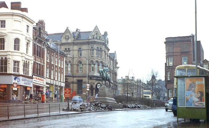
|
The southern side of Queen Square. |
|
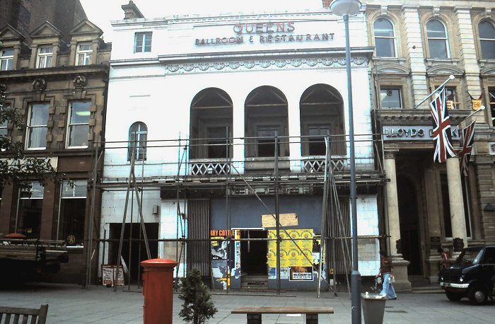
A fine view of the Queens Ballroom and Restaurant in
Queen Square. Courtesy of David Parsons. |
|
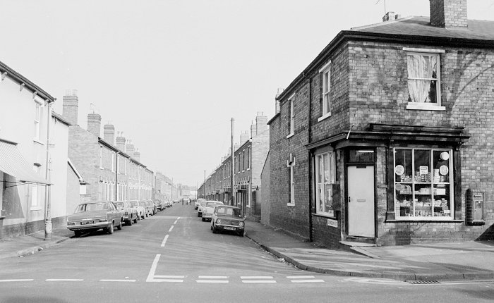
A busy shopping day in Queen Street. Courtesy of
David Parsons. |
|
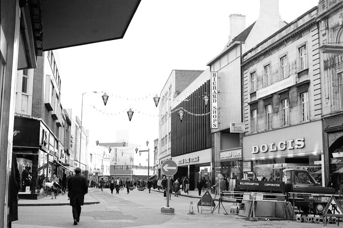
Dudley Street during pedestrianisation. |
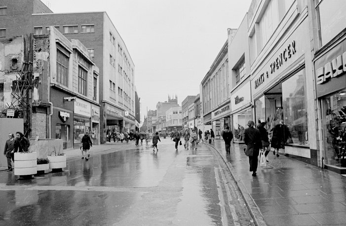
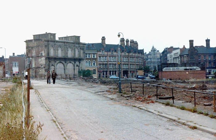
A view of Dudley Street from 1974. On the left is the
site of the recently demolished Central Arcade, shortly
after the tragic fire that took place on 20th May, 1974. |
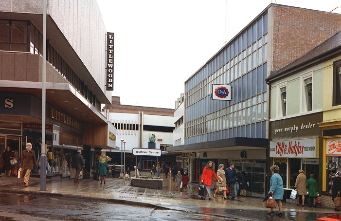
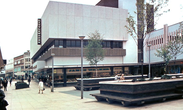
| The Mander Centre &
the Wulfrun Centre |
A view of the Mander Centre from the early 1970s, when
it was all very new. The centre opened on 6th March,
1968. |
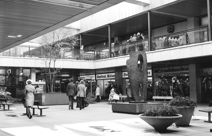
Looking into the Wulfrun Centre from the end of Dudley
Street in the mid 1970s, long before the overall roof
was added in the 1990s |
|
Another view of the Wulfrun Centre, which opened in
1968. |
|
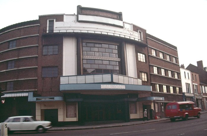
The once popular Gaumont Cinema on Snow Hill.
Courtesy of David Parsons. |
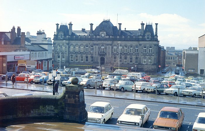
The large car park that was on the site of the Civic
Centre. The photograph was taken in 1975 just before
work began on the Civic Centre. The car park had been
there since 1962, after the old retail market had been
demolished. |
|
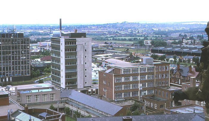
A view of Wolverhampton Polytechnic (now the University)
from St. Peter's Church tower in 1988. |
|
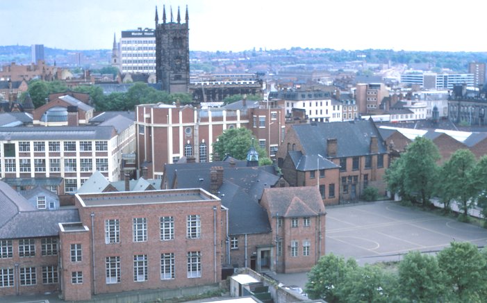
A view of the old St. Peter's School from the
Polytechnic's 'C' Block in 1971. |
The old shops in Broad Street between Westbury
Street and St. Mary's Street, awaiting demolition.
Courtesy of David Parsons. |
|
The backs of the shops in the previous photo. |
|
The Chubb Building seen from Broad Street, looking
towards Railway Street. Courtesy of David Parsons. |
|
Looking along Old Mill Street towards the Queens
Building and Lichfield Street. Courtesy of David
Parsons. |
Looking across Horseley Fields with St. James Square
on the left and Pipers Row in the background.
Courtesy of David Parsons. |
|
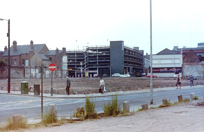
An early 1970s view of Darlington Street and the old
shops that were demolished to make way for the extension
to Fold Street Car Park. |
 |
Return to
the
previous page |
|