This important junction joins the Shropshire Union directly to the Staffs and Worcs and, within a mile, to the BCN. It also joins the work of Brindley with that of Telford, and early canals with later canals. The junction is still important to pleasure boating both for those cruising and those who have a marina and club house nearby. The canal and its associated buildings and structures make an important whole. Most of the buildings at the junction are now listed or locally listed and all of them are included on this page. Listed:
Locally Listed:
Conservation Area:
Comment: The report made to the City Council when local listings in this area was being considered was based on research carried out by the council's Conservation Officers. Their general introduction is as follows:
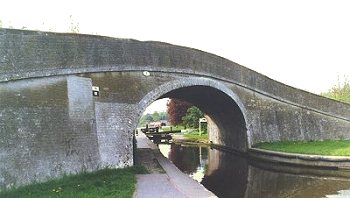
Each structure is listed below, in the order shown in the councils' report. The comments are also largely taken from that report. Bridge Number 1 (Autherley Junction Bridge)
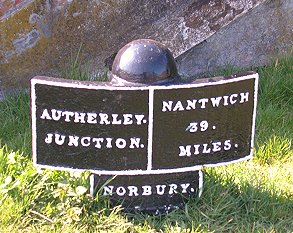
Mile Post
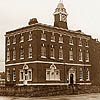
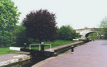
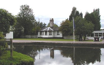
The Canal House The Canal House is mid 19th century in origin and L shaped. It has a slate hipped roof with a large central chimney stack. The windows are 20th century. It has a cambered arch doorway with a plank door and a strong canal architecture feel which subsequent alterations have not diluted. It would have housed one of the canal company employees involved in general management of the site but this part of its history has not been uncovered. The Toll Hut The Toll Hut is a small building situated by the Stop Lock which is much altered from its original style. However, it is a rare surviving example and is of considerable historic value. It is not clear when this particular construction dates from but is likely to be later than the Toll Office (1830). It has a large chimney and a flat roof. The Stop Lock
Building over the by pass weir On the off‑side of the canal is a small, hipped, slate roofed, brick building located over the bypass weir around the Stop Lock. It is probably more recent than others on the site but still appears on the 1884 ‑90 edition of the Ordnance Survey maps. It is not clear what the original function of this building was but it is likely to have been used in connection with maintaining water flow in the weir. The Toll Office
Stable Blocks There are two stable blocks remaining. Both are now painted, and one has kept its original sub‑divisions and has the original slate roofing material, which has unfortunately been 'turnerised', including raised timber louvres on the ridge. The second building has recently been altered and now has an artificial slate roof and the louvre boxes have been sealed up and so have lost their original appearance. These blocks appear on the 1884‑90 OS maps and on an 1878 map. It is thought that the stables date from the 1860s. There was a third building between them at the back which was visible on earlier maps as late as the 1938‑46 edition of the OS. The stables are a useful reminder of the importance of horses to the functioning of the canal. One of the blocks would have been reserved solely for the stabling of the fly‑boat horses. The stable blocks have retained much of their original architectural detail and are important survivors of the canal operational buildings. The stable blocks are included in the Local List. Lifting Bridge Between the stables where the towpath passes in front of the complex is a small canal basin which is accessed from the canal. The tow path crosses the mouth of the basin using a counter‑balanced lifting pedestrian bridge which is itself worthy of note. It is painted white at present and seems to be in full working order. The bridge may not be original but a bridge may have been required in this position and the present bridge has some intrinsic construction interest. This bridge is included on the Local List. Canal Cottage There is a small two storey canal cottage with bay window and narrow outbuildings behind; slate roof and single chimney on one side. It is in good condition and has retained most of its original exterior features. This cottage was used by the horse keeper who was required to attend to the horses full time.
|