| What follows is a short selection of photographs that I took
in the 1970s which show parts of the town that have now changed.
Since the photographs were taken, the area around King Street
has changed beyond recognition, due to large scale demolition,
and the building of the two successive ASDA stores. The
high-rise flats are now a thing of the past, as are some of the
factory chimneys that can be seen in the background of several
photographs. The 1970s were an interesting, and sad time, when
the old manufacturing town began to disappear forever, to be
transformed into today's modern suburb.
Bev Parker. |
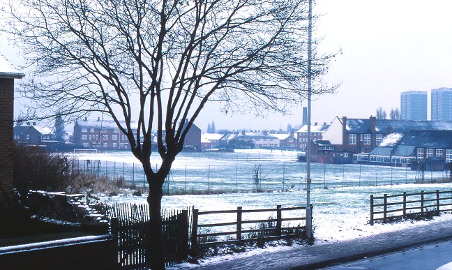
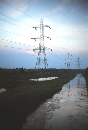
A winter's view across Pinfold Street
School playing fields, as seen from Moxley Road. Since the
photograph was taken, houses have been built in the
foreground, the school buildings have been extended, and
Longmore's chimney has been demolished, as have the
high-rise flats; John Wootton House and Great Croft House. |
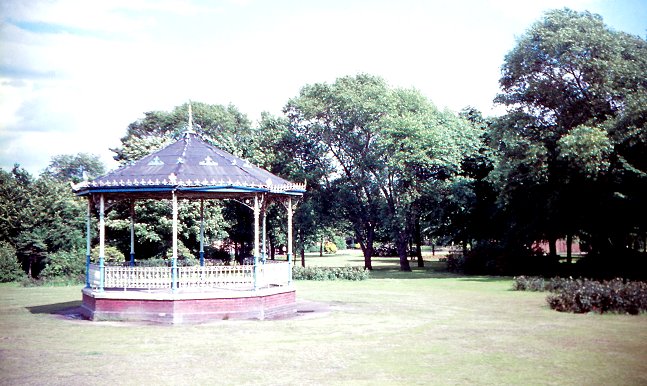
The old bandstand in George Rose Park.
For many years George Rose Park was an important
recreational area for the town, but in recent times it's
importance has diminished, and the park is now a mere shadow
of its former self. The park has suffered from a lack of
investment, and has greatly deteriorated. Schemes for
rejuvenation have come and gone, and today its future is
uncertain. |
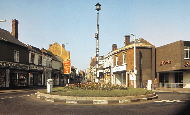
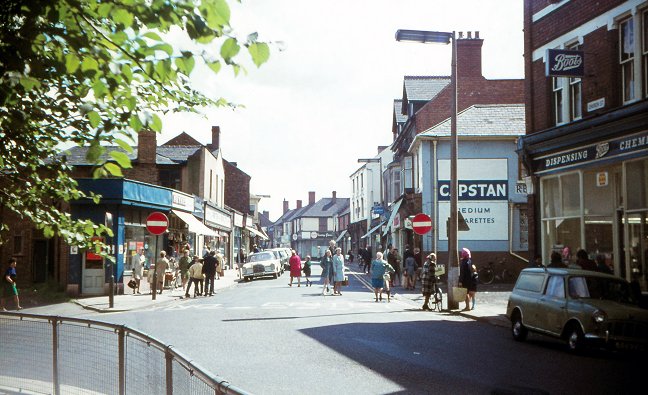
The once-familiar Bull Stake at the
bottom of King Street. On the left are some of the many
popular shops that were to be found in the old town centre.
Middletons on the extreme left had been a feature of the
town for many years, selling toys, records, prams, and
nursery furniture. Next door was William Hill's bookmakers,
'The Cabin Café', a fashionable
meeting place, Decorarte wallpaper and paint shop, and
Sketchleys dry cleaners. Other familiar shops on the
left-hand side of King Street included Phillip's chemist,
Dewhurst's butchers, the Hitachi TV and Radio shop, Firkin's
the bakers, Lipton's supermarket, and Boots the chemist, now
across the road.The many
shops on the right-hand side included Patricia's fashions,
Kingstons butchers, Howard Brothers radio, tv, and record
shop, Bedworths, our first supermarket, Burton tailoring,
Hancox & McCarthy's jewellers shop, and J. T.
Underwood's shoe shop, all part of the old vibrant town. |
|
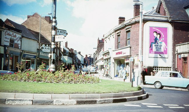
A slightly earlier view of the Bull Stake
taken on a warm summer's afternoon. |
Looking into King Street from Church
Street, around 1970. Shops on the left included Paynes shoe
repairs, Stantons the bakers, J. T. Underwood's shoe
shop, and Hancox & McCarthy's jewellers shop.
Shops on the right included Boots the
chemist, Winestores wines and spirits shop, A. F. Parsons
newsagents, and Stanburys mens outfitters and tailors. |
 |
|
 |
|
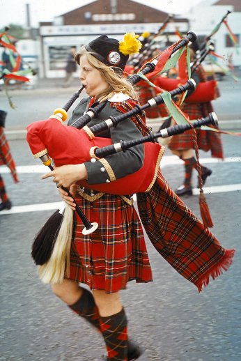
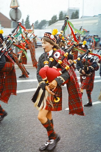
Two images
from the Darlaston carnival, once a popular event in
the town. I believe these were taken in 1976. |
|
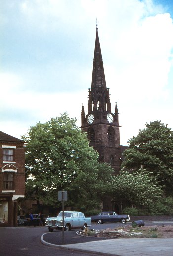
Looking across to St. Lawrence's Church
from the junction of New Road and New Street. At the time, New
Road was the site of Darlaston's 'folly', a row of 1960s shops
that were never used because they were built back to front. |
|
The Walsall Branch of the BCN at Moxley.
On the left are flooded sand pits where the Black Country Route
is today. The sand was especially prized by local foundries,
including John Wilkinson at Bradley Ironworks,
because it was fine-grained and so ideal for detailed work. |
A row of houses that stood on the northern
side of Moxley Road by the canal. Behind the house on the left
was a stable block for the horses that were used on the canal.
On the opposite side of the road, alongside the canal, stood a
small overnight stopping place for the boatmen. Inside were
wooden benches on which they could sit, or sleep. There was a
well, and a coal-burning stove for cooking and heating. Whilst
staying overnight, their horses were cared for in the stables.
Part of the end wall of the overnight accommodation, and a
window, can still be seen by the canal towpath in between Moxley
Road and the Holyhead Road. |
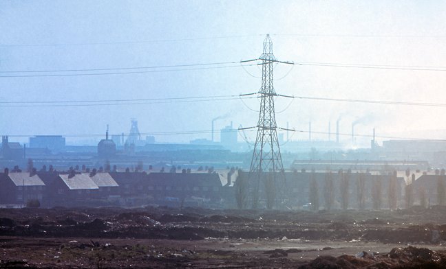
Looking across Moxley tip towards Moxley
housing estate and Bilston steelworks. A typical industrial
scene at the time. |
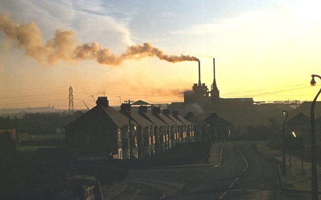
The Darlaston Green furnaces of Bradley &
Foster Limited seen from Bentley Road North. Wrexham Avenue is
on the left. |
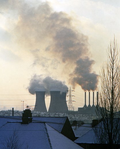 |
A once familiar sight on the Darlaston
skyline was Ocker Hill power station, which was built by the
Midland Electric Corporation, soon after its formation in 1897.
The following year the M.E.C. became the first company to get
statuary powers to distribute electricity over a large area,
which included Bilston, Brierley Hill, Cradley Heath, Darlaston,
Kingswinford, Old Hill, Tipton, Wednesbury and Willenhall. The
power station was built on 14 acres of land to supply the
power. The generating hall with
its four tall chimneys, and the three cooling towers became a
well-known local landmark that could be seen from miles around.
The coal-fired power station was
replaced by gas turbine-driven generators in 1977. The cooling
towers survived until September 1985, and the power station closed in
1996. |
| In anyone has any photographs of old Darlaston that I can
add to this section, please
send me an email. |
 |
Return to
the
previous page |
|