|
By the later part of the 18th
century, the growing industries, particularly in
Birmingham, had an expanding appetite for coal from the
Black Country, especially for the vast deposits in the
area around Wednesbury and Tipton.
Road transport was not a viable
option, because many of the local roads were totally
unsuitable for heavily laden vehicles. A few roads were
adequate, particularly those looked after by turnpike
trusts, but most others were in a poor state, totally
unsuitable for wagons and carriages in winter, or after
a period of heavy rain, when they were dangerous for
travellers. The solution to the problem was to build
canals, which eventually resulted in a complex canal
network that for many years was essential to the growth
of the Black Country.
The Staffordshire and
Worcestershire Canal
The first canal in the area was the
Staffordshire and Worcestershire Canal, connecting the
River Severn at Stourport to the Trent and Mersey Canal
at Great Haywood. It was surveyed by James Brindley (his
last completed canal), which used Brindley’s contour
method that followed the natural land contours
wherever possible, to avoid the building of locks and
tunnels.
Work began at Stourport in 1768 and
the canal was navigable as far as Compton in November
1770. Building work progressed rapidly, and the whole
46½ miles of canal was declared open at the company's
board meeting on the 28th May, 1772. Much of the capital
costs were provided by Wolverhampton tradesmen and
landowners, who greatly profited from the new canal,
which was extremely successful for the first 40 years of
its life, until the newly completed Worcester &
Birmingham & Canal acquired much of its coal traffic.
There are only 43 locks along the
whole length of the canal, 31 of which raise it about
292 feet above the Severn to the summit plateau starting
at Compton. The remaining 12 locks lower the canal from Gailey to the junction with the Trent and Mersey Canal
at Great Haywood. Three of the locks at the Bratch,
in Wombourne, are unique in Britain because they are built
close together and appear to be a staircase.
|
|
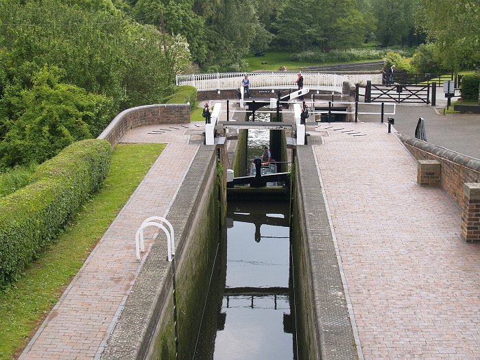
A narrow boat ascending the Bratch
locks, at Wombourne. |
|
In 1835 the Birmingham & Liverpool
Canal opened, joining the Staffordshire & Worcestershire
Canal at Autherley Junction. The 39½ mile-long canal
extends to the Ellesmere & Chester Canal at Nantwich and
was engineered by Thomas Telford and built at a cost of
£800,000 to link Liverpool with the Birmingham Canal
Navigations, which at the time carried about 3 million
gross tons of goods, much of which was coal. It was of no great benefit to the
Staffordshire & Worcestershire Canal, even with its
charges, as the new traffic only travelled along the
canal for about half a mile between Autherley and
Aldersley Junctions. The Birmingham & Liverpool Canal is now part of the Shropshire
Union Canal.
The BCN - Birmingham Canal
Navigations
The Birmingham Canal Navigations (BCN)
was built to transport coal from the Black Country
coalfields in the Wednesbury area to Birmingham. In
January 1767 a public meeting was held in Birmingham to
discuss the building of a canal that would connect
Birmingham to the Shropshire and Worcestershire Canal
via the Black Country's coal mines, and Wolverhampton.
By August, sufficient capital had been raised to fund the
project, and a Bill allowing construction was passed in
Parliament in February 1768. James Brindley was
appointed as engineer, and the Birmingham Canal
Navigations was incorporated on the 2nd March, 1768.
Work soon got underway. The section
from Birmingham to Wednesbury opened on the 6th November,
1769 to transport coal from collieries at Hill Top. In 1770 the canal arrived at Tipton, and
reached Wolverhampton in August 1771, but the final
downhill section to Aldersley Junction took another year
to complete, because it required the building of 21
locks. Initially 20 locks were built, but because of the
large drop at the bottom lock, an extra lock was added.
The Canal opened on 21st September, 1772, just 8 days
before Brindley's death.
|
|
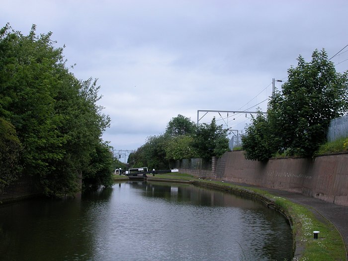
Lock number two on the
downhill section to Aldersley Junction. |
|
The circuitous route followed the
natural contours to avoid as much large scale
engineering work as possible, and the total distance of
12½ miles as the crow flies, from Birmingham to
Wolverhampton, was covered in just over 22½ miles. The
canal was a great success. Large quantities of coal,
limestone, sand, and Rowley ragstone were transported
far more cheaply and quickly than ever before,
benefiting both the canal company and the mining
companies alike. The canal company went from strength to
strength as the canal expanded and other canal companies
were taken over.
By the 1820s the BCN carried a lot
of traffic which was greatly hampered by the circuitous
route. Something had to be done to speed the flow of
traffic and so in April 1824 Thomas Telford
was engaged to survey the canal with the idea of
shortening and improving the route. Many of the bends
were cut off and a new straight line was built between Smethwick and Bloomfield, which shortened the canal by 7
miles.
|
|
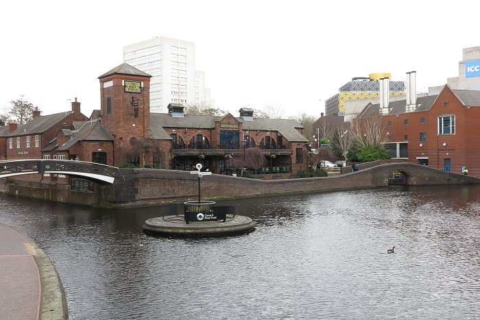
Old Turn Junction on the BCN at
Birmingham. |
|
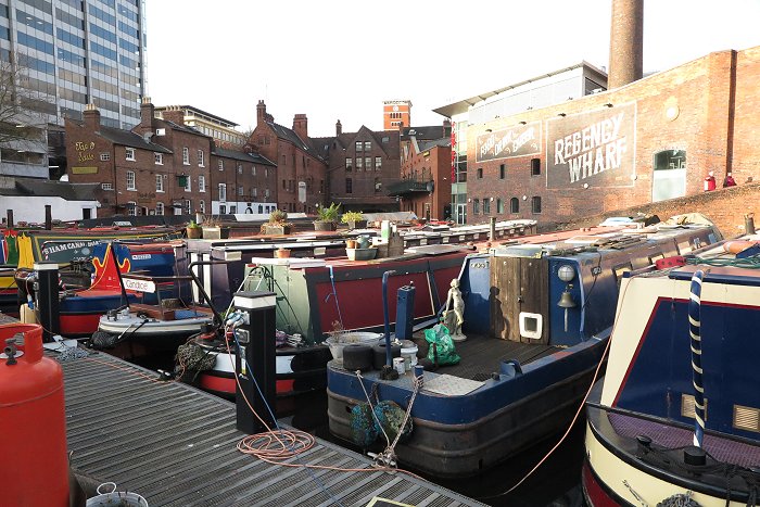
Boats moored at Gas Street Basin,
on the BCN at Birmingham. |
|
The Stourbridge Canal
Another offshoot of the
Staffordshire & Worcestershire Canal is the Stourbridge
Canal, which was built as a link to Stourbridge from Stourton. The canal was originally surveyed by James
Brindley in 1766 when he was surveying the Staffordshire
and Worcestershire Canal, but nothing could be done
until an Act of Parliament was passed in April 1776. At
the same time, the Act authorising the construction of
the Dudley Canal was passed. It runs from Dudley to the
Fens Branch of the Stourbridge Canal.
The Stourbridge Canal came into use
on 3rd December, 1779 and for many years was extremely
successful, due to the many local industries that it
served.
|
|
The Dudley Canal
The Dudley Canal, promoted by Lord
Dudley, was 2¼ miles in length and included a flight of
nine locks at Black Delph and a reservoir at Woodside.
Work was completed on the 24th June, 1779, and opened
with the completion of the Stourbridge Canal in December
of the same year. As the canal was totally dependent
upon the Stourbridge Canal, the decision was taken to
construct a tunnel beneath Dudley so that the canal
could be extended to join the BCN. An Act of Parliament
allowing the construction was passed on the 4th July,
1785 and the 3,172 yards long tunnel opened for business
on the 15th October, 1792. The canal also took a lot of
traffic from the Staffordshire & Worcestershire Canal,
offering a faster route to Birmingham.
| |
|
| Read the story
of the Dudley Canal Tunnel |
 |
| |
|
In the late 17th century the east
side of Castle Hill and southern Tipton was part of the
Earl of Dudley's Coneygree Deer Park. Most of the
remainder was farming land. This all began to change as
people started to exploit the mineral wealth in the
area. Coal mines and limestone mines began to appear.
Initially mining was on a small scale, but when the
canals appeared it all changed.
In 1792 a canal was planned to
connect the quarries at Netherton to the Worcester &
Birmingham Canal at Selly Oak. An Act of Parliament was
Passed in June 1793 and work got underway under the
supervision of the company's engineer John Snape.
Unfortunately he died in 1796 and so his assistant
William Underhill took over. The canal ran from the
Dudley Canal for nearly 11 miles, just over 2 miles of
which ran through a tunnel at Lapal. The canal suffered
from many problems, mainly due to subsidence. The Lapal
tunnel had to be closed in 1917 following a roof fall.
|
|
The Wyrley & Essington Canal
The Wyrley & Essington canal was
planned to link the coalfields of Wyrley and Essington
to the Birmingham Canal at Wolverhampton. An Act of
Parliament was Passed on the 30th April, 1792 to allow the
work to commence. Much of the finance came from
Wolverhampton businessmen, principally the Molineux
family. Work soon started under the canal company's
engineer, William Pitt. There were two branches, one to
a colliery at Essington and the other to Birchills near
the centre of Walsall. The canal joined the Birmingham
Canal at Horseley Fields and opened on the 8th May, 1797.
Being a contoured canal and following an extremely
circuitous route, it became known as "The Curly Wyrley".
On the 5th February, 1840 the BCN amalgamated with the
Wyrley & Essington Canal.
Other extensions to the BCN
The Walsall Canal was built under
the terms of an Act passed by Parliament on the 24th June,
1783, which included the Toll End Branch. It was
surveyed and designed by John Smeaton, the first
self-proclaimed civil engineer. The canal had eight
locks at Rider's Green, and reached Wednesbury in 1786.
It finally opened to Walsall in 1799.
An Act in 1874 allowed the
Broadwaters branch to be extended through Darlaston to
Walsall. The whole stretch from Ryders Green to
Walsall became known as the Walsall Branch.
In 1845 the BCN was leased by the
London & Birmingham Railway, and from 1846 by its
successor, the London & North Western Railway.
Also in 1846 the BCN amalgamated
with the Dudley Canal (Dudley No. 1) and the Dudley No.
2 Canal. This would eventually be good news for the
Dudley No. 2 Canal because in 1858 the Netherton Tunnel
opened to provide a direct link to the BCN and remove
the bottleneck caused by the narrow Dudley tunnel and
the Lapal tunnel. Work began on the 27ft. wide, 3,027
yards long Netherton Tunnel in December 1855. The new
tunnel allowed the use of two-way traffic and so was a
great improvement over the two one-way tunnels.
|
|
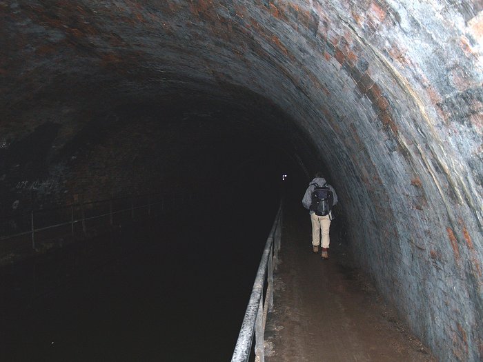
The Netherton Tunnel. |
|
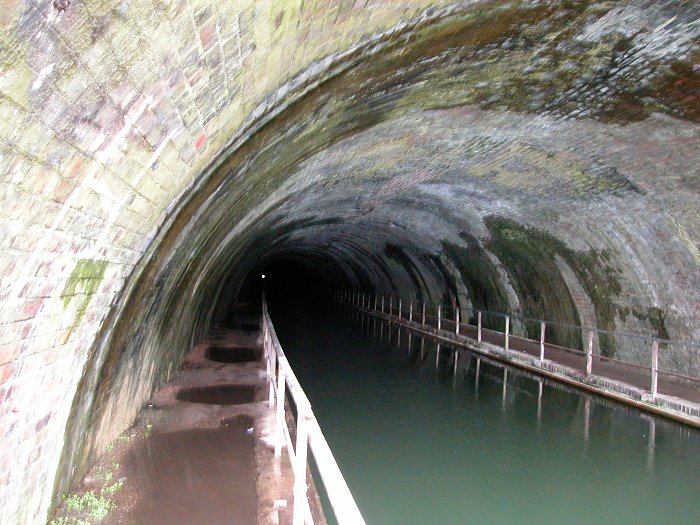
Another view inside the
Netherton Tunnel. |
|
Successes and Improvements
The large quantities of coal,
limestone, raw materials, and finished goods that were
transported on the canals at the time, made the canal
companies very wealthy, greatly benefiting their
shareholders. Large factories sprung-up alongside the
canal, and the population of many local towns rapidly
grew thanks to the employment on offer. The cost of some
of the items for sale in the shops fell due to large
scale manufacturing and ease of transport, which led to
a greater variety of goods being found in the shops.
The large scale textile and garment
manufacturers in Derbyshire, Lancashire and Yorkshire
relied on the canals to transport their goods, which
could quickly be delivered to the Midlands, reducing the
cost of clothing, and increasing the variety that was
available.
The canal network was connected to
sea ports, so that manufacturers could easily export
their products. Many imported goods were readily
available for the first time. The falling cost of coal
reduced people’s heating bills and the large amount of
raw materials and goods that were transported, allowed
traders in the local towns to easily provide the
expanding population with all of their needs.
In the 20th century the canals lost
much of the commercial traffic because of competition
from the railways and a massive increase in road transport.
By the 1950s, many canals had closed or were in terminal
decline. When railways were nationalised in 1948,
commercial traffic was actively encouraged, but road
transport continued to dominate, especially when
motorways were built in the 1960s.
Luckily canals had a new lease of
life, thanks to the many volunteers who actively carried
out work to repair and reopen them. Many of the canals were no longer navigable. In 1948 the canals came under
the control of the British Transport Commission. In 1962,
under the Transport Act, the canals became part of the
new British Waterways Board. As leisure boating on the
canals became popular, money was available for
restoration and conservation projects. By the 1990s
grants were also available from the Heritage Lottery
Fund. In 2011 the canals came under the Canal & River
Trust, and their popularity for leisure activities
greatly increased. Today there are large numbers of
narrow boats on hire for holidays on the
canals. So much so that their future is now secure.
|

Parkhead Locks. From an old postcard.
|
|
Return to the
previous page |
|