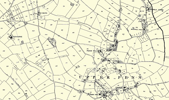
| Upper Penn began life as a small farming community, centred
around Vicarage Road and St. Bart's Church, with fields covering
around 1,300 acres, stretching southwards towards Gospel End, eastwards
towards Wolverhampton Road East, westwards towards Merry Hill and
northwards towards Goldthorn Hill. As time
progressed and Penn Road was improved by the turnpike trust, set up
in 1761, cottages, shops and public houses also appeared there.
The 1843 tithe map of Penn provides us with a unique snapshot of
life in the old farming community, which would soon change beyond
recognition. At the time there were around 700 inhabitants in Upper
Penn and very few buildings. Most people worked on the land, or in
service to the few wealthy families who lived in the large houses.
It would have been a largely self-sufficient community in which
people supplied neighbours with fruit and vegetables etc. and looked
after reach other's interests. There were just a few local shops on
Penn Road, Woodlands Cottages and at the bottom of Church Hill,
along with public houses on Penn Road and at the top of Church Hill.
The local school, Penn School, run by Edward Perry, was in Springhill
Lane. |